Discover the top off-road map apps for outdoor enthusiasts; featuring detailed maps, GPS tracking, offline access, and trail info.
The best off-road map apps are; Gaia GPS, AllTrails, onX Offroad, Backcountry Navigator, and Hema Explorer. They provide accurate and detailed maps, reliable performance, and useful features for navigating off-road trails, all while being user-friendly and accessible on iOS and Android devices.
As an avid off-roader myself, I understand the importance of having accurate and reliable information at your fingertips. That's why I've taken the time to thoroughly test and evaluate each app to ensure that I am providing you with the most trustworthy and up-to-date information. With my research, expertise, and knowledge, you can trust that you're getting the best recommendations for your off-road map app needs.
Key Takeaways
- Off-road map apps offer accurate and clear maps for navigating trails.
- Many GPS apps offer downloadable offline maps for use in remote areas.
- Features like user-recorded tracks and public land info help plan and customize trips.
- Compatibility with iOS and Android devices makes these GPS apps more accessible.
This article may contain affiliate links where we earn a commission from qualifying purchases.
Best Off-road Map Apps
The performance of best off-road map apps depend on various factors, such as the quality and accuracy of google maps, the app's user interface, the availability of offline maps, and the speed and stability of the app itself.
The table below briefly highlights some features of the best off-road map apps currently available in the market.
1. Gaia GPS
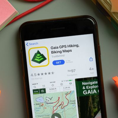
Gaia GPS
Gaia GPS is the best off-road map app that offers a comprehensive set of features for Overlanding, 4x4, OHV, and ATV enthusiasts. It provides high-quality maps and trail data to help you plan your next adventure and navigate through the wilderness with ease. Here's what you need to know about the Gaia GPS app:
Specifications
Gaia GPS is available for both iOS and Android devices. It offers a free version with limited features and a premium version that costs $3.33 per month (billed annually) or $39.99 per year. The premium version provides more access unlike google maps, features, and tools, including offline maps, custom ways, and real-time weather updates.
Performance
Gaia GPS is known for its fast and reliable performance. The app employs advanced GPS technology for accurate location tracking and a real-time navigation app. With its low battery usage optimization, the app enables extended usage, which is particularly useful when you're on the go and deep in remote areas.
What Sets it Apart
As a hiker and off-road enthusiast, you no longer have to worry about getting lost. This innovative app offers over 300 different Google Maps for outdoor adventurers that cover many activities, including but not limited to hiking, backpacking, skiing, and driving on rough roads.
The extensive trail data provides users with essential knowledge such as trailhead locations.
Recent Updates
With frequent updates, Gaia GPS keeps its app up-to-date with new features and maps. The latest updates have brought improved offline downloading maps, better trail data, cell service, and additional route planning and tracking tools.
Benefits
- A comprehensive collection of maps and trail data
- Accurate location tracking, Polaris GPS navigation, and ordnance survey
- Optimized for low battery usage
- Regular updates and new features
Drawbacks
- The premium version can be expensive for some users
- Some users report occasional bugs and glitches
Who Should Use It
With Gaia GPS on your phone, you’ll never need another app when preparing for outdoor adventures. Whether you are hitting the ski slopes, off-roading, or exploring new hiking trails, being equipped with this app is vital. It has useful navigational maps and features like an offline tracking mode. In essence, it offers everything you need for navigation right at your fingertips.
Where to Get It
You can get it by downloading it on your mobile device through either App Store or Google Play Store. Free versions are available, providing basic services alongside higher-level access included within premium subscriptions.
2. AllTrails

AllTrails
Offering access to many maps clearly crafted by hand, AllTrails stands out as one of the most sought-after mobile applications available today. This map app allows you to effortlessly track your progress with a built-in road GPS app while gaining valuable insights into popular trails from fellow adventurers.
Here is what you need to know about AllTrails:
Specifications
AllTrails is available for both iOS and Android devices. The app is free to download, but there is also a paid version called AllTrails Pro. The app's Pro version includes a range of additional features that can enhance your navigational experience.
Other bonuses include gaining access to exclusive travel itineraries and special discounts on hotels when booking through the app.
Performance
AllTrails is a very reliable and user-friendly app. Accurate information about trails is just a few taps away with this app. Its comprehensive database includes key details about various hiking trails such as their level of difficulty and where they begin. The app's search feature also lets users record their progress while sharing insights with fellow hikers.
What Sets it Apart
AllTrails distinguishes itself from other best off-road map apps through its extensive compilation of precise and hand-crafted raster maps. Additionally, the app has a highly engaged user community who generously share their experiences and offer valuable guidance.
Recent Updates
The updated app now has better search functionality and advanced off-road navigation apps. It also provides highly accurate off-road maps that provide crucial information about each hike. It can also help you keep tabs on changing weather conditions right from within the application.
Benefits
- Offers access to the largest collection of detailed, hand-curated trail maps in the world
- User-friendly interface
- Has a community full of active users, sharing their experiences and offering helpful tips and recommendations.
- Ability to track progress and share experiences with others
- Real-time weather updates
Drawbacks
- The free version of the app has limited functionality
- In comparison to other best off-road map applications, the Pro version of this app is expensive.
Who Should Use It
Apart from facilitating the exploration of new hikes and easy sharing of experiences with fellow outdoor lovers and those off-roading, this app caters to both seasoned hikers as well as beginners.
Where to Get The App
Users can access AllTrails by downloading it onto their devices via either the App Store or Google Play. While there are some limitations between the free version and the Pro version of this app, it’s still one of the best GPS apps for discovering new trails out there today!
3. OnX Offroad
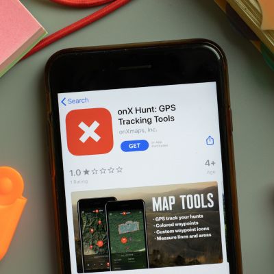
OnX Offroad
OnX Offroad is the go-to app for anyone who wants to go off-road driving confidently. It offers highly elaborate motor vehicle use maps of public lands and private landowner info, GPS tracking, and the ability to download offline maps.
All these are wrapped in a user-friendly interface that makes off-road driving a breeze!
Specifications
Both iOS and Android device users can access the OnX Offroad application with ease. It , however, requires a minimum of iOS 13.0 and Android 6.0 to run. The app is 101.8 MB in size and is available in the English language only.
Performance
AS an off-road enthusiast, you can take advantage of the OnX Offroad and its nifty GPS mapping features for quick and easy access to various remote areas.
Navigating through the app's menus using its interface is effortless. This is because you can search for trails based on your preferences such as skill level, length of the route, type of automobile, and other related factors.
The app also lets you download maps for offline access, which is great for when you're in areas with no cell phone coverage.
What Sets it Apart
The OnX Offroad app is designed with virtually all the info users need to confidently and safely plan their next adventure. The app has over 615,000 miles of nationwide trails and counting.
It also provides information on property boundaries, landowner names, and acreage information. The app has a feature that lets you create custom waypoints, which is great for marking spots on the trail that you want to remember.
Recent Updates
The onX Offroad has had several recent updates. The latest updates were built with various intriguing features ensuring the app runs optimally.
Some of these upgrades include newly introduced trails and revamped old hiking routes. The software's developers also included a whole new level of experience for hikers by providing an easier way to share their favorite trails with loved ones while also allowing them to upload pictures on the app.
Benefits
- Easy-to-use interface
- Filter trails based on your preferences
- Download maps for offline use
- Provides information on property boundaries, landowner names, and acreage information
- Create new waypoints
Drawbacks
- Not all trails are mapped in rich detail yet
- Only available in the English language
Who Should Use it
With easy-to-use navigation and detailed maps, these apps are perfect for anyone who wants to explore new trails, plan exciting trips, or just find their way through challenging terrain.
Where to Get it
The OnX Offroad app can be downloaded on the App Store and Google Play Store. The app costs $29.99 per year for the Premium version and $99.99 per year for the Elite version.
4. Backcountry Navigator
Are you in search of the best off-road map app? Look no further than Backcountry Navigator. It’s highly popular among outdoor enthusiasts and offers multiple features that come in handy when exploring uncharted territories like national parks.
Here's what you need to know.
Specifications
Backcountry Navigator is available for Android devices and can be downloaded from the Google Play Store. It requires Android 4.0.3 or higher to run. You can purchase a yearly subscription for $19.99 (billed once) or a monthly subscription for $3.99.
Performance
For nature enthusiasts who venture into remote areas, Backcountry Navigator is a dependable and efficient app that surpasses expectations.
It excels in providing top-quality offline maps, which can be accessed in locations with poor network coverage.
With its simple interface and inclusive mapping options, this app is ideal for hikers, campers, or any outdoor enthusiast.
What Sets it Apart
A feature that makes Backcountry Navigator different from other on-road and off-road map applications includes its vast collection of maps.
The app houses many paper maps and a built-in compass, such as topo maps, satellite imageries, and detailed street maps. It also allows you to import your own maps, which can be useful if you have a specific area you want to explore.
This app offers a unique offline mapping functionality that sets it apart from the rest. This is because it’s not restricted just to cell connectivity.
Recent Updates
It was updated a year ago to include bug fixes and performance improvements.
Benefits
- Online and offline maps
- Extensive map library
- Ability to import your own maps
- Easy to use
Drawbacks
- Some features require a subscription
- Only available for Android devices
Who Should Use it
By providing a Polaris GPS navigation app and route mapping features, it's perfect for activities such as hiking, camping, and off-roading.
Where to Find it
You can download Backcountry Navigator from the Google Play Store.
5. Hema Explorer
Navigate nature's playground with confidence using the Hema Explorer map app. The app has highly detailed topo maps that cover on-road and off-road adventures, national parks, and public lands throughout the USA.
It's perfect for outdoor enthusiasts who love to explore. Its weather reports, alerts feature, and ability to save Avenza maps for offline use make it a valuable tool for planning and executing your next off-road trips.
Specifications
The Hema Explorer 4WD Maps App provides offline digital maps for off-road navigation. It has comprehensive coverage of 4WD maps with over 690,000 km of 4WD tracks and 545,000km of unsealed road maps featured on the Hema Map.
The app also offers satellite and hybrid Avenza maps available from Mapbox with the option to add more layers. It requires iOS 10.0 or later and is compatible with iPhone, iPad, and iPod touch.
Performance
The Hema Explorer 4WD Maps App is an excellent off-road navigation app with road GPS app tracking and highly accurate track information.
The app is user-friendly and easy to navigate, making it an ideal choice for remote travel. It’s fast, reliable, and provides excellent coverage of 4WD tracks and trails across the U.S. and Australia.
What Sets it Apart
What sets the Hema Explorer 4WD Maps App apart from others is its comprehensive coverage of unsealed roads featured on the Hema Map.
The app also offers satellite and hybrid Avenza maps available from Mapbox, with the option to add more map layers. It’s a reliable and user-friendly app that provides excellent coverage of 4WD tracks and trails across Australia and the United States.
Recent Updates
The Hema Explorer 4WD Maps App has recently been updated to provide more accurate and up-to-date information on 4WD tracks and trails across Australia.
The app now offers satellite and terrain maps available from Mapbox, with the option to add more map layers. The latest update also includes bug fixes and improvements to enhance the user experience.
Benefits
- It offers comprehensive coverage of 4WD maps and unsealed roads both in Australia and U.S.
- The app provides GPS tracking
- Highly accurate track information
- An ideal choice for remote travel.
Drawbacks
- Older devices are incompatible with this app
- Only functions on iOS operating systems version 10.0 or later installed.
- Can be problematic in areas with unstable internet
- Doesn’t support Android devices
Who Should Use It
If you're planning an off-roading adventure or looking for a reliable navigational aid as a hiker or camper, you must consider the Hema Explorer 4WD Maps App.
The app caters to newbies and experts alike thanks to its easy-to-use feature.
Where to Find It
The Hema Explorer 4WD Maps App is available for download on the App Store for iOS devices. It is not currently available for Android devices. The app is free to download, but you can also purchase additional map layers for a fee for trip planning.