Don't let getting lost ruin your off-road fun. Arm yourself with the best navigation technology for your next adventure.
The best off-road navigation systems are Avenza Maps, Google Maps, Garmin Overlander, Gaia GPS, and Topographic Maps. These navigation apps combine functionality, durability, and user-friendly design to provide reliable guidance when you're far from the beaten path.
I've taken enough time to research and compare the top off-road navigation systems, ensuring our recommendations are both credible and reliable. My expertise in this area ensures that I provide accurate information and guidance, empowering you to make well-informed decisions when selecting the perfect navigation solution for your off-road adventures.
Key Takeaways
- When it comes to off-road navigation, accurate maps and directions are crucial.
- An easy-to-use interface and intuitive controls make off-road navigation simpler.
- Offline functionality is essential for navigation in remote areas.
- Compatibility with different devices makes off-road navigation more convenient.
This article may contain affiliate links where we earn a commission from qualifying purchases.
Best Off-road Navigation
When choosing the best off-road navigation, there are a few key factors to consider.
First and foremost, you should consider the type of maps and terrain data available through the navigation app or device.
Another critical factor is the level of customization and flexibility the navigation tool offers, including options for creating and saving custom routes.
Additionally, you should consider the ease of use of the navigation tool, including the user interface and the availability of helpful features like turn-by-turn directions and real-time traffic information.
Durability and reliability are also important factors, particularly for off-road use where conditions can be rough and unpredictable.
1. Avenza Maps
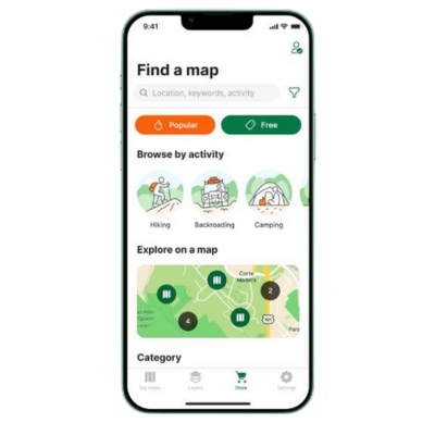
Avenza Maps
Avenza Maps is highly regarded for its off-road navigation capabilities and extensive map database. It's a popular off-road navigation app that offers many maps for off-roading and back-road adventures.
Specifications
It's available for both iOS and Android devices. Also, it provides offline map access, GPS location tracking, map importing, and a comprehensive collection of specialty off-roading maps from around the world.
Performance
This navigation tool performs well in various off-road conditions with accurate GPS navigation and tracking. You can also download maps that show your exact location while offline, making it a reliable partner in remote locations.
What Sets It Apart
Some distinguishing features include USFS Motor Vehicle Use Maps (MVUM), National Geographic maps, and other specialty off-road maps from various providers.
Additionally, its dedication to navigating rough terrain or national park makes it an excellent choice for enthusiastic and experienced off-road adventurers.
Recent Updates
With regular updates, Avenza Maps improves its functionality and adds new features to cater to the needs of the off-roading community. This app constantly expands its map database and enhances usability in rough terrain, making it an evolving tool for all adventurers.
Benefits
- Extensive map database with specialty off-roading maps.
- Offline use and GPS location tracking.
- Map importing and exporting capabilities.
- User-friendly interface and regular updates.
Drawbacks
- Its coverage might be limited to specific geographic regions.
- Some users may also find it costly as certain map providers charge additional fees for their maps.
Who Should Buy It
Off-road enthusiasts, overlanders, and adventurers looking for a reliable navigation app with an extensive map database and offline access will find this navigation app a valuable tool. It caters to the needs and preferences of the off-roading community, making it worthwhile for those who frequently explore remote locations.
Where to Buy It
You can download the Avenza Maps app from the Avenza Maps Store or Apple App Store for iOS and Google Play Store for Android devices.
2. Google Maps
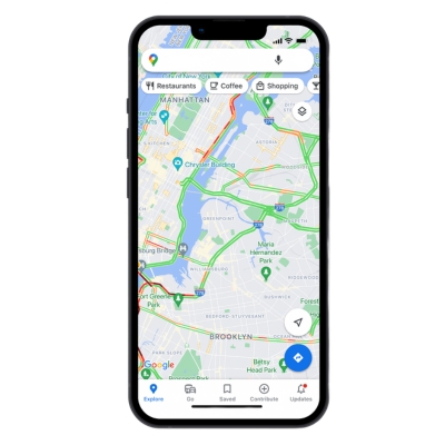
Google Maps
As one of the most widely used navigation tools, Google Maps offers a variety of features to assist users in off-road navigation. Although it may not be specifically designed for off-road adventures, its capabilities are still impressive and can prove effective in many situations.
These satellite maps provide a comprehensive suite of navigation and mapping features that can be beneficial for both urban and off-road travel.
Specifications
It offers satellite messaging, street maps, 360-degree street views, real-time traffic conditions, and route planning that can also be applied to off-road navigation.
It’s available on iOS, Android, and web-based platforms. In addition, it can show the user’s exact location when used in off-road vehicles.
Performance
This navigation tool performs well for off-road navigation for essential exploration and route planning. Its maps are constantly updated, ensuring users can access the latest terrain and road data.
However, its off-road capabilities may be limited compared to dedicated off-road navigation apps.
What Sets it Apart
It stands out as the best GPS due to ease of use, widespread adoption, and continuous updates. The vast database of locations and points of interest makes it a helpful tool for finding off-road destinations and planning routes.
Recent Updates
Regular updates to Google Maps include expanded coverage, improved map data, and a few features that can assist users in their off-road navigation.
Benefits
- Free to use.
- Easy access on multiple platforms.
- Real-time traffic and road conditions.
- Regular map updates.
Drawbacks
- Limited off-road-specific features.
- Requires internet connection for optimal performance.
Who Should Buy It
It's ideally suited for casual off-road enthusiasts needing a free, easy-to-use navigation tool. It may not provide the depth and specificity that dedicated off-road navigation systems offer, but for many users, it can serve as a reliable and accessible choice.
Where to Buy It
As a free service, Google Maps can be accessed through the Google Maps website or by downloading the Google Maps app on iOS and Android devices.
3. Garmin Overlander
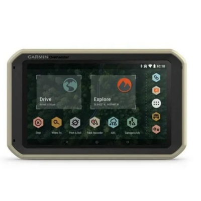
Garmin Overlander
Garmin Overlander is a top choice for adventurers keen on overlanding and off-grid expeditions. Its robust design and tailored navigation functions make it the ultimate tool for those venturing into uncharted territory.
Specifications
It comes with a 7-inch touchscreen display, which is glove-friendly and easy to read in sunlight. In addition, it allows on- and off-road navigation through preloaded maps, topographic data, and public land boundaries.
Performance
It’s a reliable off-road GPS system designed for adventure seekers. It has a 7-inch touchscreen display with detailed mapping for North and South America and a built-in pitch and roll display to inform you about your vehicle's angle.
Additionally, it features preloaded topographic maps, photo waypoints, street maps, and satellite imagery to provide you with a complete and up-to-date picture of your surroundings. It also includes downloading additional maps, routes, and satellite images directly to the device.
Besides, its rugged design that is IP5X rated for dust and water resistance and a magnetic mount ensures easy installation. Additionally, the Garmin Explore app allows you to sync your tracks and waypoints with your mobile device for easy sharing and tracking.
What Sets it Apart
It provides a multipurpose navigator that ensures you have both on and off-road guidance. With its high-sensitivity GPS, GLONASS, and Galileo satellite support, you can have accurate location data, even in the most remote areas with no cell signal.
Additionally, this street GPS navigator features a built-in compass, altimeter, and barometer, further enhancing its off-grid capabilities.
Recent Updates
As a cutting-edge navigation system, it continually receives software updates to improve performance and ensure users can access the latest features and map data. These updates are essential for maintaining optimal functionality, accuracy, and reliability when off-roading.
Benefits
- High-precision navigation tailored for off-roading.
- Rugged and waterproof design.
- Preloaded maps and topographic data.
- Easy-to-use interface.
Drawbacks
- It has high price points.
Who Should Buy It
It's an ideal choice for off-road enthusiasts, overlanders, and backcountry explorers who require a rugged, reliable, and precise navigation system to accompany them on their adventures. In addition, its versatile functionality also makes it suitable for off-roaders that traverse both urban and wilderness environments.
Where to Buy It
You can purchase and download it from the official Garmin website and retail adventure stores.
4. Gaia GPS
Gaia GPS
Gaia GPS is a popular app for off-road and overland navigation, offering users an extensive library of maps, trail info, and information for planning their next adventure. A vast selection of 4x4 and overland maps enable outdoor enthusiasts to discover new dispersed camping spots and plan off-road expeditions efficiently.
Specifications
It’s available on Android and iOS devices, with a range of subscription plans to suit users' needs. In addition, the app can be used with or without an internet connection on multiple devices; downloading maps for offline access allows for uninterrupted navigation during off-grid adventures.
Performance
Users appreciate this app's comprehensive off-road maps, detailed route information, and user-friendly interface. This app consistently provides accurate navigation data, making it a reliable choice for off-road enthusiasts.
What Sets It Apart
This navigation tool boasts a vast map database, integration with Trails Offroad, and advanced planning tools – all specifically tailored for the off-roading community. Additionally, it sets itself apart by providing access to a growing database of over 2,400 routes, focusing on off-road driving and planning capabilities.
Recent Updates
The partnership with Trails Offroad is a recent and significant update to this GPS unit, greatly expanding the selection of available off-road trails and information. This collaboration ensures a continuously updated database, providing users with adventurous new opportunities.
Benefits
- Extensive map library.
- Integration with Trails Offroad.
- Offline use.
- User-friendly interface.
- Accurate navigation data.
Drawbacks
- Subscription-based access.
- A learning curve is required for new users.
Who Should Buy It
Off-road enthusiasts, overlanders, and adventurers who require reliable navigation tools and detailed planning capabilities will find Gaia GPS particularly useful.
Where to Buy It
You can purchase and download Gaia GPS through the Gaia GPS website, the Google Play Store, and Apple App Store.
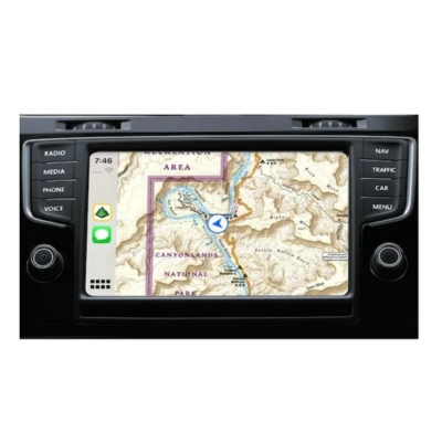
5. Topographic Maps

Topographic Maps
Topographic maps are essential for off-road driving, as they provide detailed information about a specific area's terrain, elevation, and natural features. These maps can help off-roaders plan their routes more effectively and avoid potential obstacles or hazards.
Specifications
These maps typically display contour lines that represent elevation changes, with the distance between lines indicating the degree of the gradient. They may also include natural features such as forests, bodies of water, vegetation, and human-made structures like roads and buildings.
Notably, the level of detail on these maps varies, but generally, the most advanced options provide scale ratios, coordinate systems, and extensive area coverage.
Performance
Based on performance, these maps can do well in various off-road situations, allowing users to plan routes and navigate paved roads accurately. In addition, they enhance safety and confidence during off-road trips by providing information on elevation, obstacles, and natural features.
What Sets it Apart
They set themselves apart from other map types by offering a detailed terrain representation. Additionally, they provide invaluable insights into elevation changes and obstacles that are especially helpful for off-roaders, ensuring safer exploration and more accurate route planning.
Recent Updates
These detailed maps have come a long way from their traditional paper counterparts. Many off-road navigation systems, such as Gaia GPS and onX Offroad, now offer digital topographic maps with more up-to-date and comprehensive information.
These updates may include real-time trail closures, public land boundaries, private land data, and seasonal changes.
Benefits
- Detailed terrain representation.
- Improved route planning and navigation.
- Enhanced safety during off-road trips.
- Customizable features and data in digital formats.
Drawbacks
- The initial learning curve for interpreting contour lines.
- Potential outdated information for paper maps.
- It may require other devices or subscriptions for digital versions.
Who Should Buy It
These navigation tools are ideal for off-roaders of all skill levels seeking a comprehensive navigation solution to enhance their outdoor adventures. They are especially useful for those who frequently explore challenging and remote with no cell service, requiring accurate and detailed information to navigate safely.
Where to Buy It
You can download Topographic Maps, also known as Topo Maps, from Google Play Store for Android phones or Apple App Store for iOS.
Additionally, paper maps may be obtained from local outdoor stores.